The Amsterdam Canals: History, Facts & Why They’re UNESCO-Listed
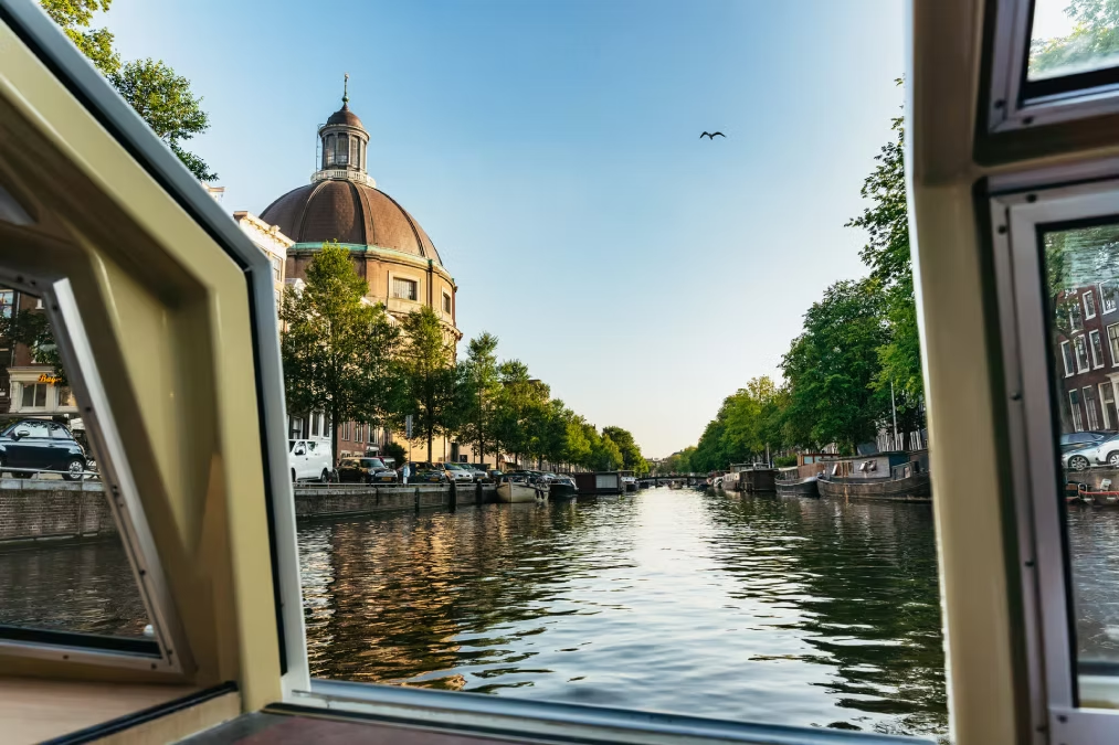
Amsterdam’s canal ring (grachtengordel) was built between 1613 and 1665 during the Dutch Golden Age — the period when Amsterdam was the wealthiest and most commercially powerful city in the world. The ring consists of three concentric canals (Prinsengracht, Keizersgracht, and Herengracht) dug as a planned urban expansion to house Amsterdam’s rapidly growing merchant population. UNESCO inscribed the canal ring as a World Heritage Site in 2010, recognising it as an outstanding example of planned urban development.
Amsterdam’s canal ring is often called beautiful — which it is — but beauty is the least interesting thing about it. What makes the canal ring one of the most significant urban achievements in European history is the ambition and speed with which it was built, the social and economic system that financed and organised it, and the extraordinary fact that it has remained largely intact for four centuries in a city that has never stopped being actively used.
This guide covers the full history of Amsterdam’s canals — from the medieval origins of the city through the Dutch Golden Age construction of the ring, to its current status as a UNESCO World Heritage Site and the most visited part of the Netherlands.
Top Tickets
Amsterdam Before the Canal Ring: Medieval Origins
Amsterdam began as a small fishing village on the Amstel River in the late 12th century. A dam was built across the Amstel around 1270 — the “Amstel dam” that gives the city its name. The settlement grew along the river and the IJ waterway, developing a modest medieval canal network for drainage and trade access. By 1400, Amsterdam had a population of approximately 5,000. By 1600, on the eve of the Golden Age, it had grown to 50,000.
The Amsterdam of the medieval period was a small trading town on an inhospitable site — a swampy river delta where the Amstel met the IJ waterway. The land was too soft for conventional construction and too low for conventional drainage. Everything that was built had to be driven into the unstable ground on wooden piles. Everything that moved had to navigate waterways rather than roads, because roads on the marshy peat simply did not hold.
This physical constraint produced a city that was organised around water by necessity before it was organised around it by choice. Amsterdam’s earliest canals — the Singel (the original moat around the medieval city), the Herengracht’s predecessor waterways, the internal city channels — were drainage and transport infrastructure before they were the aesthetic centrepiece of a planned urban vision.
What changed in the late 16th century was the scale of Amsterdam’s wealth. The city that had been a moderate regional trading centre became, through a series of political and commercial accidents of history, the most commercially powerful city in the world.
The Dutch Golden Age: Why Amsterdam Became the World’s Richest City
The Dutch Golden Age (roughly 1585–1720) was the period when the Dutch Republic — and Amsterdam in particular — dominated world trade, finance, and culture. The fall of Antwerp to Spanish forces in 1585 redirected the centre of northern European trade to Amsterdam. The founding of the Dutch East India Company (VOC) in 1602 gave Amsterdam command of the spice trade with Asia. By 1620, Amsterdam’s port was the busiest in the world and the city’s merchant class was accumulating wealth at a rate without precedent in European history.
The Dutch Golden Age created the conditions for the canal ring’s construction. Without the extraordinary wealth generated by the VOC, the spice trade, and Amsterdam’s role as the centre of European finance, there would have been no money to build the ring, no population growth to make it necessary, and no merchant class with the means and ambition to construct the canal houses that line it.
Several factors converged to make Amsterdam the world’s commercial capital in this period:
The fall of Antwerp (1585). When Spanish forces sacked Antwerp — then the dominant commercial city of northern Europe — the city’s merchants, bankers, and skilled workers fled north, many to Amsterdam. This migration brought capital, networks, and expertise to Amsterdam almost overnight.
The VOC (1602). The Dutch East India Company was the world’s first publicly traded joint-stock company — effectively an early corporation that could raise capital by selling shares. The VOC gave Amsterdam merchants organised, financed access to the spice trade with Asia, generating returns that funded enormous private wealth in the city.
Dutch financial innovation. Amsterdam established the Amsterdam Exchange Bank (Wisselbank) in 1609 — a stable reserve bank that underpinned commercial credit across Europe. The Amsterdam Stock Exchange (the world’s first) was established in 1611. These financial institutions made Amsterdam the centre of European capital markets.
Control of Baltic grain trade. Before the Asian spice trade, Amsterdam had already dominated the Baltic grain trade — carrying grain from Poland and Russia to the grain-deficit countries of southern Europe. This earlier dominance established the shipping infrastructure and merchant networks that the VOC later leveraged.
Building the Canal Ring: 1613–1665
The Amsterdam canal ring was constructed in two phases. The first phase (1613–1625) dug the Herengracht, Keizersgracht, and Prinsengracht from the IJ waterway south to the Leidsegracht. The second phase (1658–1665) extended the ring southward to connect with the Amstel River, completing the full horseshoe arc. The total project excavated approximately 75 kilometres of new canals and created building plots for approximately 2,000 new canal houses.
The construction of the canal ring was one of the most ambitious urban infrastructure projects in European history — comparable in its scale and ambition to Haussmann’s reconstruction of Paris two centuries later, but accomplished without any central government authority, financed entirely by private capital and driven by a city council of merchant regents.
The planning. The canal ring was designed by city engineer Hendrick Staets from 1610 onwards. His plan was simple in concept but extraordinary in scale: three concentric semicircular canals, connected by radial cross-canals (grachten), with building plots of standardised dimensions allocated along each canal bank.
The excavation. Thousands of workers dug the three canals by hand — excavating the peat and sand to a standardised depth, using the excavated material to raise the adjacent land to a usable building level. Wooden piles were driven into the sand layer 12 metres below the surface at each building plot, creating the foundation on which the canal houses would be built.
The allocation of plots. Building plots along the canal ring were sold by the city — the proceeds funding the excavation work — at prices that reflected their prestige. The Herengracht was the most expensive; the Prinsengracht the least. Purchasers were required to build according to specified setback and height regulations, creating the coherent streetscape of the canal ring while allowing individual variation within those constraints.
The speed. The first phase of construction — from the IJ waterway to the Leidsegracht — was substantially complete by 1625, just twelve years after breaking ground. This rate of urbanisation — several kilometres of new canal infrastructure and hundreds of new buildings in a decade — was extraordinary for the period.
The Canal Houses: Architecture and Construction
The approximately 1,550 canal houses that line Amsterdam’s canal ring were built between 1613 and 1730, with the majority completed between 1620 and 1700. They were not designed by a single architect or built to a single plan — each was commissioned individually by the merchant family that owned the plot.
Despite this individual commissioning, the canal houses share a set of structural constraints that give the ring its visual coherence. Each plot was typically 6 to 8 metres wide — the dimension of the standard plot as established in the canal ring plan — and 20 to 30 metres deep. This narrow width drove the characteristic tall, narrow proportions of the facades: the buildings needed to be high to provide enough floor area on a restricted footprint.
The facades are brick — the standard building material of the Netherlands — with stone details at the windows, doors, and gable ornaments reserved for wealthier owners. The gable is the defining feature visible from the canal: the step gable (trapgevel) of the early 17th century gave way to the neck gable (halsgevel) and later the bell gable (klokgevel) as architectural fashion evolved across the construction period.
For a dedicated guide to Amsterdam’s canal house architecture, see our Amsterdam’s most famous canal houses article.
The Decline of the Golden Age and the Canal Ring After 1700
Amsterdam’s commercial supremacy began to decline in the early 18th century, as British naval and financial power increasingly displaced Dutch dominance in world trade. The VOC went bankrupt in 1799. Amsterdam’s population stagnated. The canal ring stopped growing.
Paradoxically, this decline preserved the canal ring. Cities that continued to grow economically through the 19th century — Paris, London, Brussels — demolished much of their medieval and early modern urban fabric to build for a new industrial economy. Amsterdam, its commercial vitality reduced, simply did not have the capital or the motivation for wholesale urban renewal. The canal ring survived largely intact because there was no economic pressure to replace it.
The 20th century brought new threats — car infrastructure planning in the 1960s and 1970s nearly resulted in several canals being filled in to provide road space. Citizen and heritage campaigners successfully opposed the most damaging proposals. Some inner city canals were lost but the grachtengordel survived.
UNESCO World Heritage Status (2010)
UNESCO inscribed Amsterdam’s 17th-century canal ring as a World Heritage Site in 2010. The inscription recognised the canal ring as an outstanding example of planned urban development — specifically for the ingenuity of its construction on a challenging site, the coherence and quality of its architectural heritage, and its status as a model that influenced urban planning across the world from the 17th century onwards.
UNESCO’s World Heritage designation cites the canal ring specifically for its “outstanding universal value” in three areas:
Engineering and construction innovation. The canal ring was built on soft, unstable land using techniques — the systematic use of wooden pile foundations, controlled canal depth, and coordinated land reclamation from the excavated material — that were innovative in the 17th century and influenced subsequent urban construction in the Netherlands and beyond.
Architectural and urban coherence. The canal ring is one of the best-preserved examples of planned urban development from the Dutch Golden Age. The coherence of the three main canals, the uniformity of building setbacks, and the survival of approximately 1,550 historic canal houses create an urban environment of exceptional integrity.
Influence on world urban planning. Amsterdam’s canal ring influenced urban planning in cities across the world through Dutch colonial and commercial networks — from Batavia (now Jakarta) to Recife to Cape Town, Amsterdam’s canal city model was exported and adapted. The grachtengordel is the original of a type that shaped cities on multiple continents.
Key Facts and Figures
| Fact | Detail |
|---|---|
| Number of canals in Amsterdam | 165 |
| Total length of canals | Approximately 75 km |
| Number of bridges | More than 1,500 |
| Number of historic canal houses in the ring | Approximately 1,550 |
| Canal ring construction period | 1613–1665 |
| UNESCO inscription | 2010 |
| Three main canals | Prinsengracht, Keizersgracht, Herengracht |
| Number of houseboats | Approximately 2,500 |
| Foundation pile depth | Approximately 12 metres |
Frequently Asked Questions
When was Amsterdam’s canal ring built?
The canal ring was built in two phases: the first from 1613 to approximately 1625 (covering the northern arc from the IJ to the Leidsegracht), and the second from 1658 to 1665 (completing the southern arc to the Amstel River).
Why was the canal ring built?
The canal ring was built to house Amsterdam’s rapidly growing population during the Dutch Golden Age — the period of maximum commercial prosperity when the city needed to expand significantly beyond its medieval boundaries. The canals served as both transport infrastructure and property development — each canal bank provided building plots for merchant residences.
When did UNESCO inscribe Amsterdam’s canals?
UNESCO inscribed Amsterdam’s 17th-century canal ring as a World Heritage Site in 2010.
How many canals does Amsterdam have?
Amsterdam has 165 canals with a total length of approximately 75 kilometres, crossed by more than 1,500 bridges.
Why do Amsterdam’s canal houses lean forward?
The forward lean — typically one degree or more from the vertical — is a deliberate architectural feature. Goods and furniture hoisted from the street to upper floors would swing clear of the facade rather than knocking against the windows. The lean also sometimes reflects differential settlement of the wooden pile foundations over centuries.
What happened to the VOC?
The Dutch East India Company (VOC) was officially dissolved in 1799 after a period of decline driven by competition from British trade companies, corruption, and financial mismanagement. At its peak in the 17th century, it was the largest commercial enterprise in the world.